Share a story! Nominate a site.
Do you have a story to share? Do you have a site to nominate? Please fill out this form and we will get back to you.
The current Granville Bridge opened in 1954. It is the third crossing of False Creek at Granville Street, replacing a 1909 bridge that itself replaced an 1889 bridge. In 1889, a bridge also opened to Sea Island, helping farmers move their produce along Granville Street to Vancouver customers. The current bridge was built high enough, like the Burrard Bridge 20 years before it, that its span did not have to be opened for marine traffic.
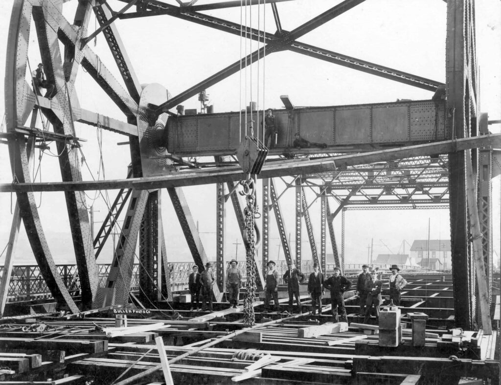
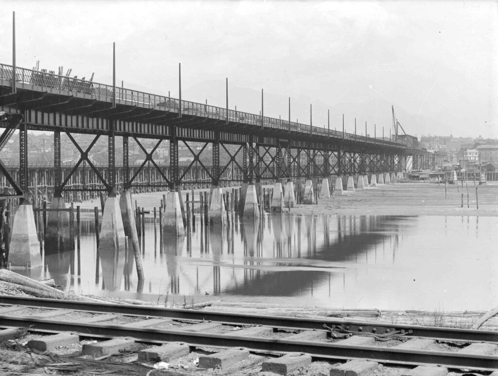
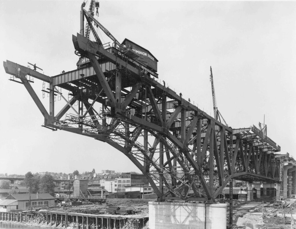
Photo credit: Steel workers on draw span, Granville St. Bridge, 1909. CVA 1376-453.
The First Granville Bridge: 1889-1909
The False Creek area is traditional, ancestral, unceded territory of Squamish, Musqueam and Tsleil-Waututh people and it was inhabited seasonally for fishing and hunting, long before the creation of a permanent village (the village of Sen̓áḵw or sən̓aʔqʷ is just west of where Granville Bridge is now). By the 1870s, settlers had established sawmills and logging roads on either side of False Creek, however the south shore remained densely forested and little developed, until Lauchlan Hamilton set up camp in 1885 to begin surveying the land for development.
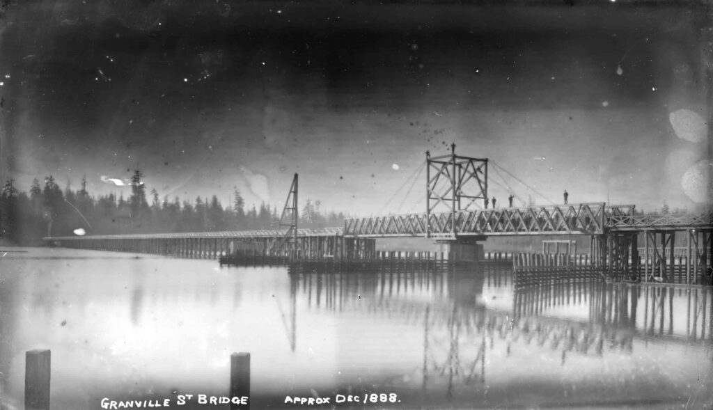
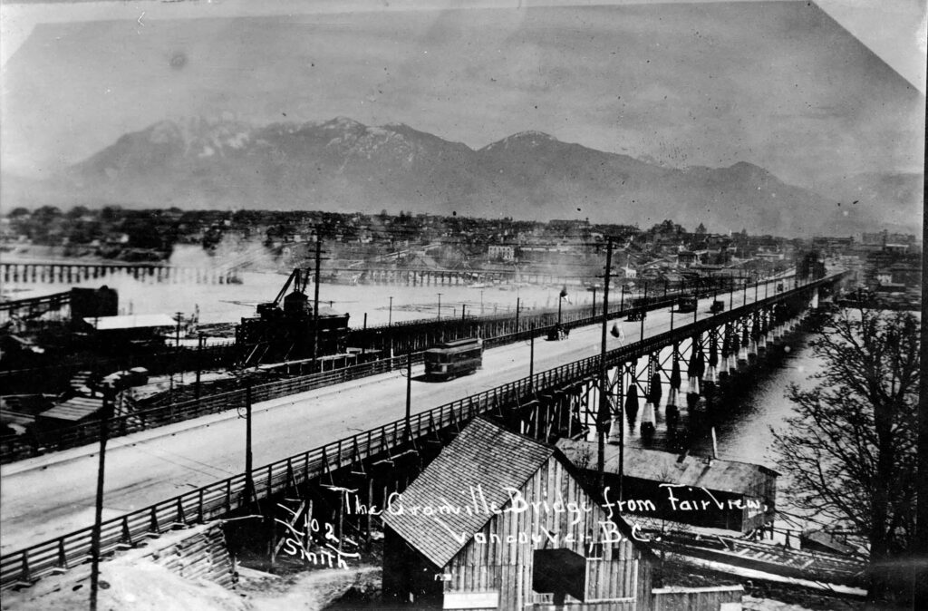
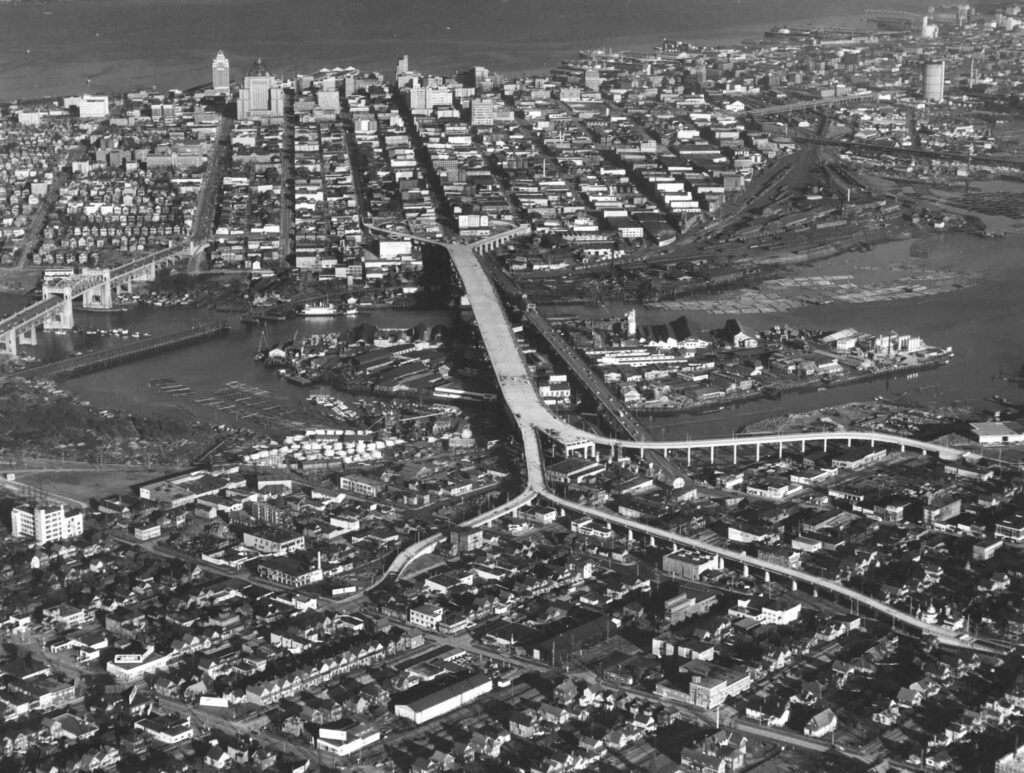
The first Granville Bridge opened in 1889, crossing from Beach Ave to 3rd Ave and was part of the scheme to clear Granville Street through to the North Arm of the Fraser River, where a bridge crossed to the farming community of Eburne. Granville Street was called Centre Street south of False Creek (until 1907) and the new slit through the forest heading south was initially known as North Arm Road. The 2,400 metre long, low timber trestle bridge opened on January 4th, costing $16,000 to build, and was designed by the Canadian Pacific Railway (CPR). It had a swingspan near the downtown side, was wide enough for two wagons, had a four-foot-wide separated path on the west side for pedestrians, and was barely above high tide – children swam from it in the summer.
Two years after it was built, the CPR cleared the Fairview Slopes and opened them for settlement; the street railway company (predecessor of the BC Electric) ran a single-track on a trestle on the east side of the bridge for the “Fairview Belt Line” which connected Granville Street, 9th Avenue (now Broadway) and Main Street with downtown, hoping it would help spur development, which it did.
The Second Granville Bridge: 1909-1954
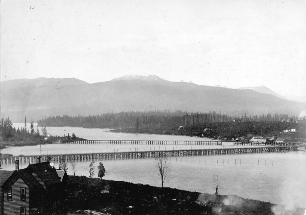
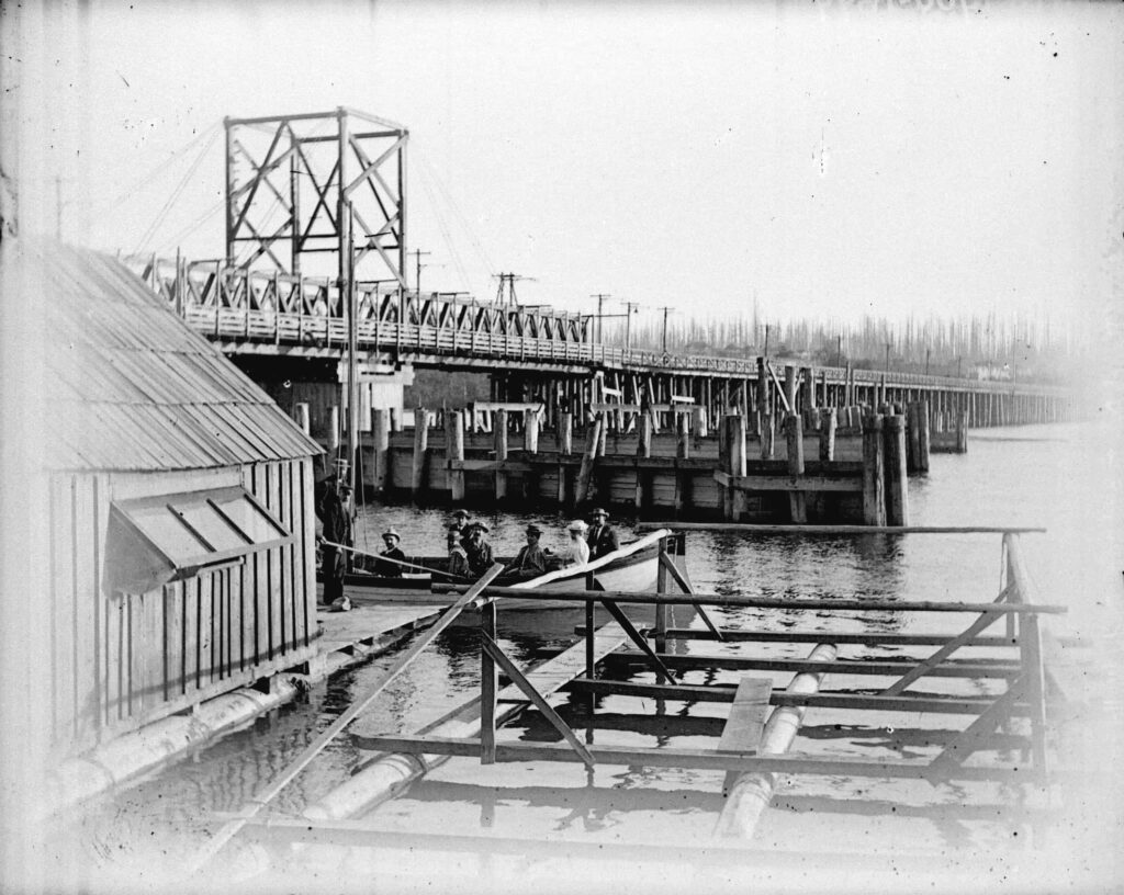
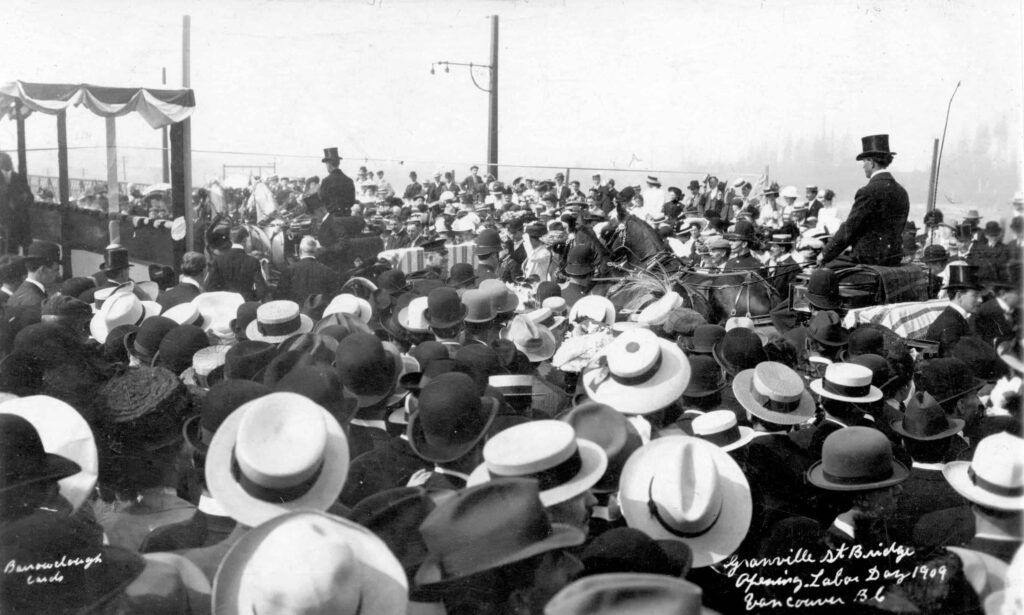
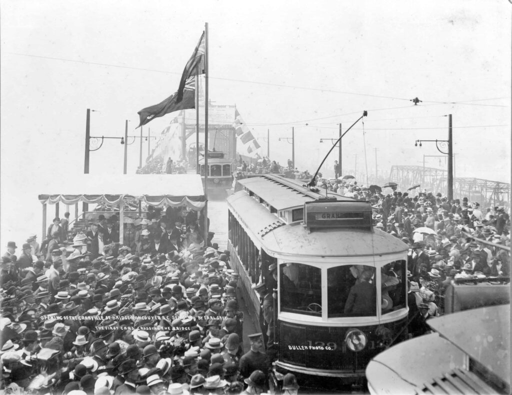
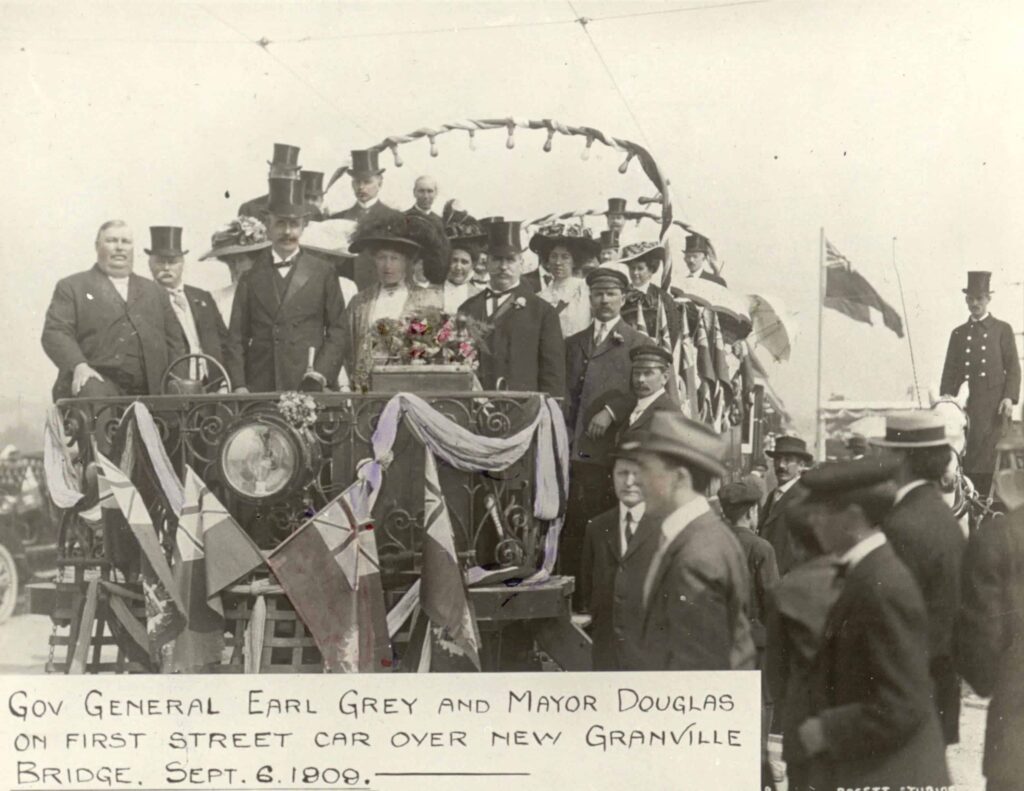
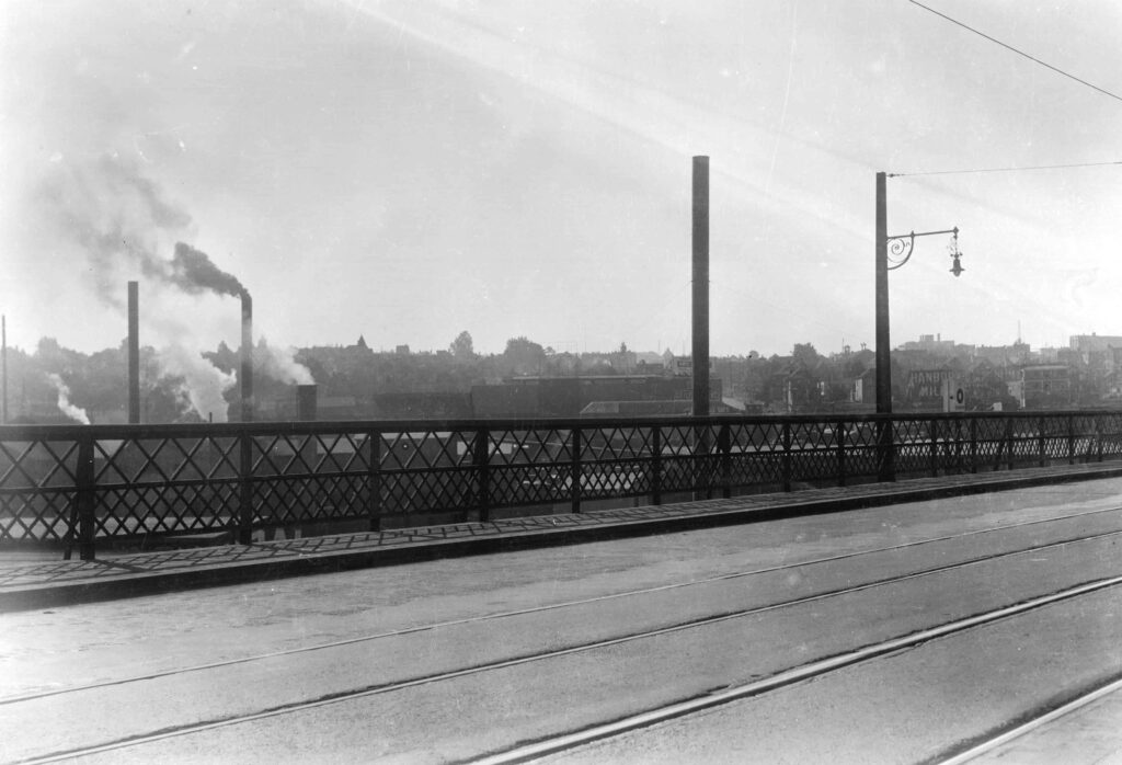
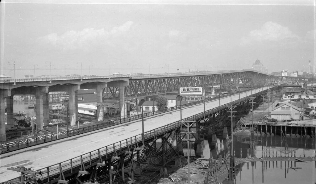
The bridge was quickly overloaded with traffic and replaced in 1909 by a medium height steel swingspan, this time slightly longer, running from 4th Ave to Pacific Street. It was built slightly east of the first bridge and it survived until the new bridge opened in 1954; Old Bridge Street on Granville Island follows the line of its footings. Its contractor was the legendary firm Armstrong & Morrison Co. Ltd., who had built the 1904 New Westminster railway bridge across the Fraser and later the 1912 Connaught Bridge at Cambie (demolished 1985), which had an identical swingspan. The new Granville Bridge is credited with speeding up the settlement of Shaughnessy and Kitsilano, as these neighbourhoods became more attractive thanks to easier access to downtown.
The Third Granville Bridge: 1954 – Present
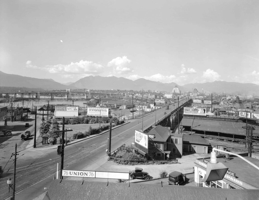
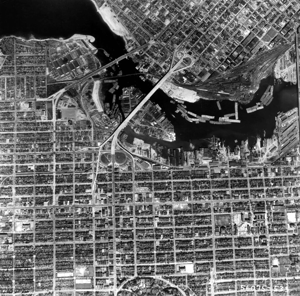
False Creek had been useful for the shipping industry during the Second World War but was considered an industrial backwater once the city began to rebuild in the late 1940s. Its water area had shrunk significantly since the city’s beginnings and many people, including mayoral candidates in the 1950 election, believed the entire creek ought to be reclaimed to eliminate the need for further bridges, to provide more industrial land and space for parking, and to provide a major arterial roadway down its centre. Although construction on the bridge had advanced too far to be stopped, Mayor Fred Hume still believed there was value in filling it altogether. A 1955 report by E.L. Cousins of the city engineering department demonstrated that filling in the rest of the creek would cost more than the value of the industrial land created. False Creek survived as an industrial waterway until new ideas began to emerge in the 1960s, imagining it as a residential and recreational asset.
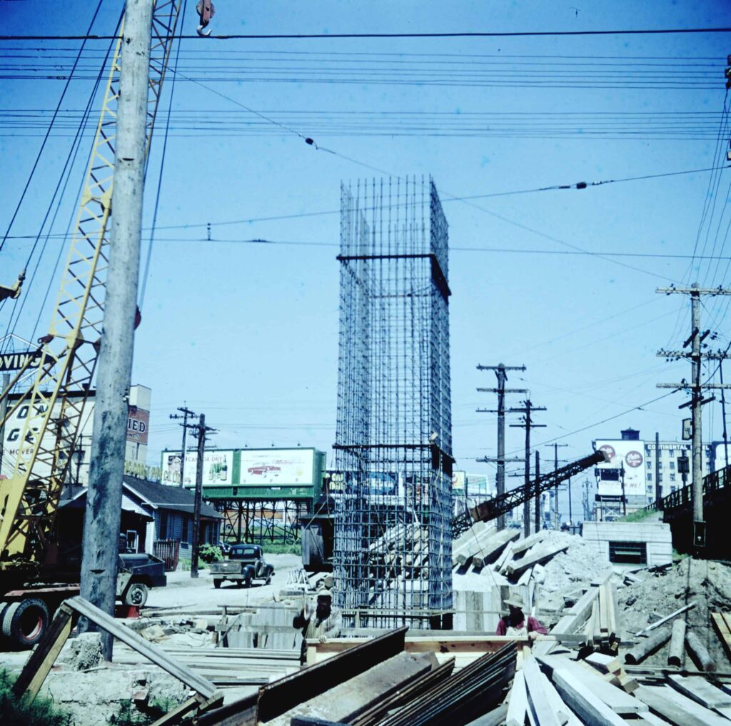
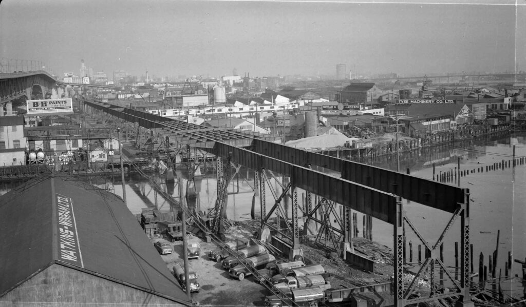
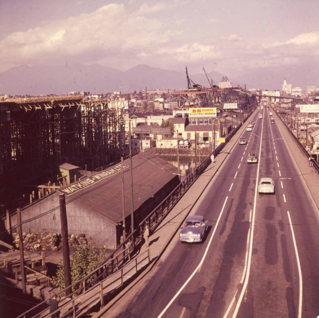
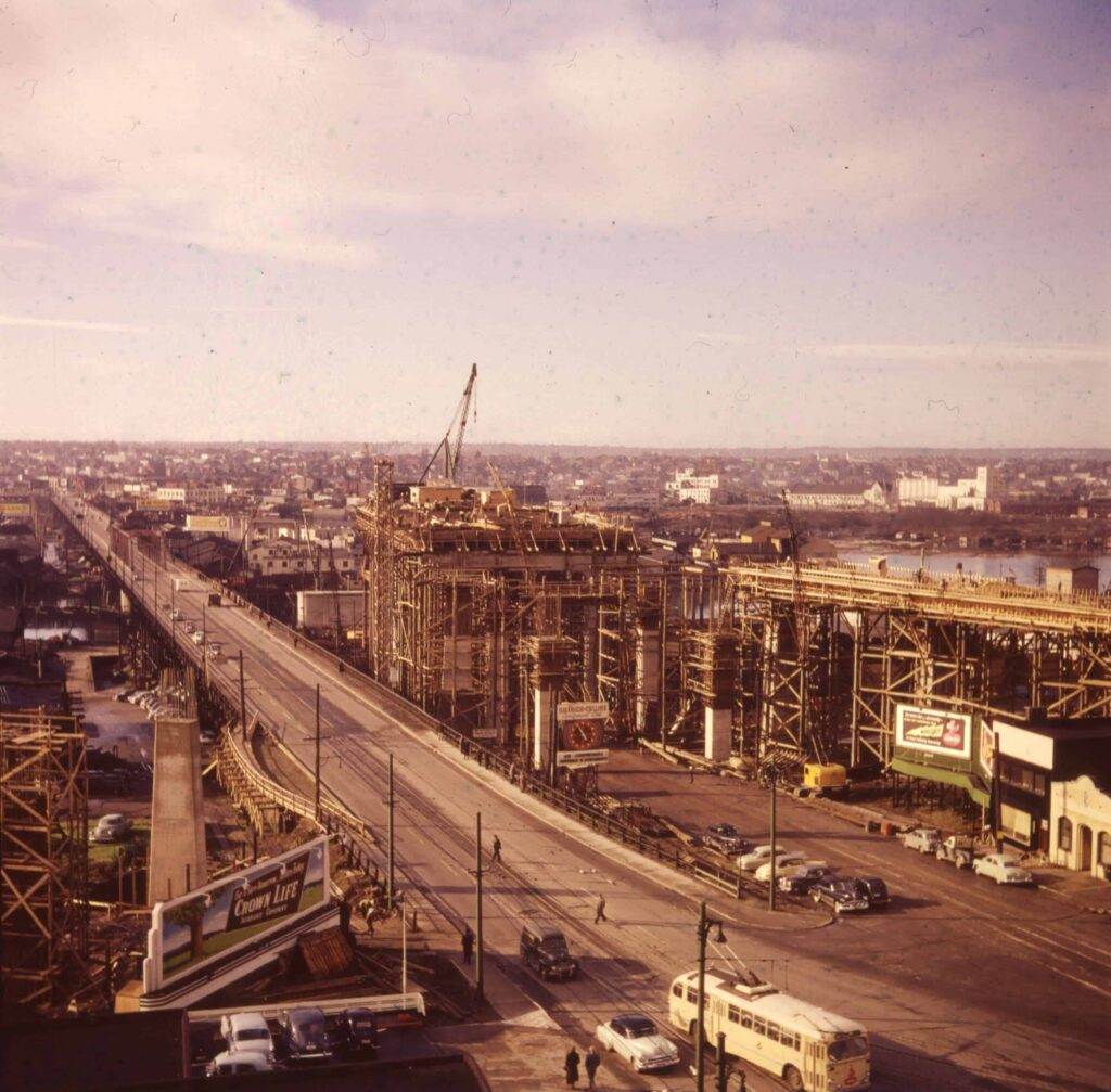
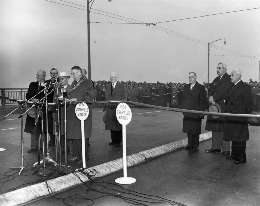
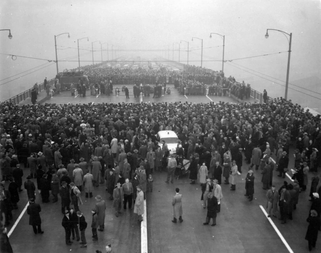
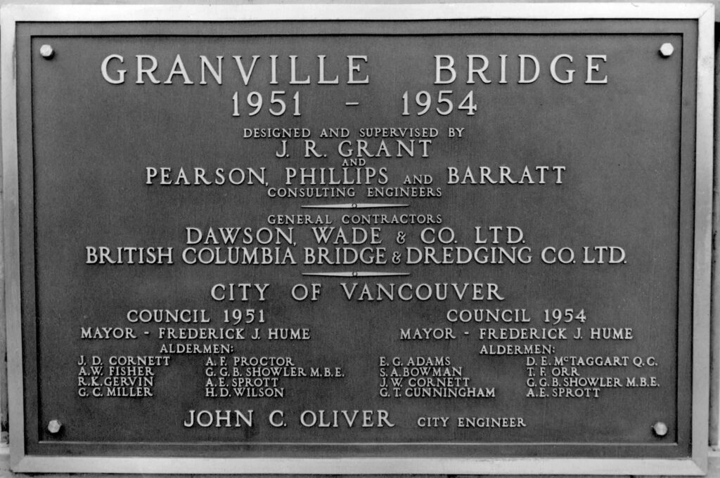
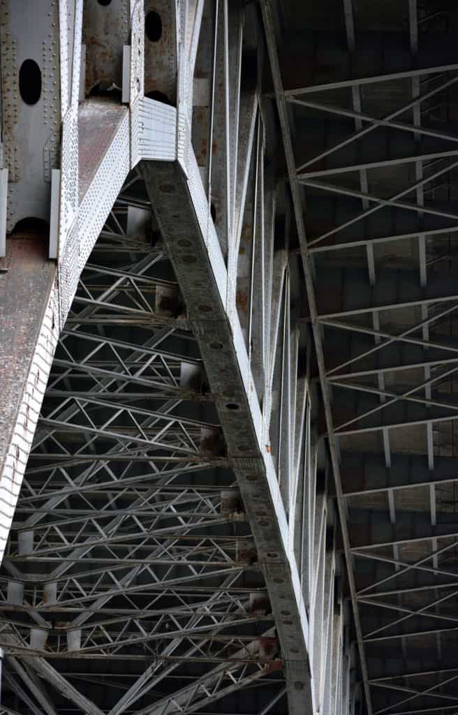
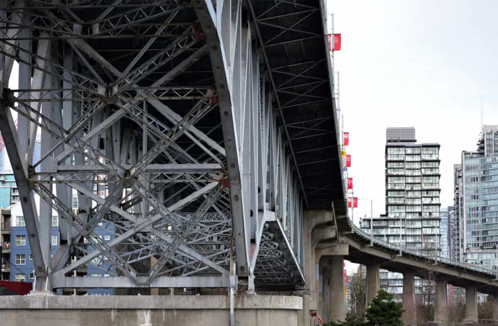
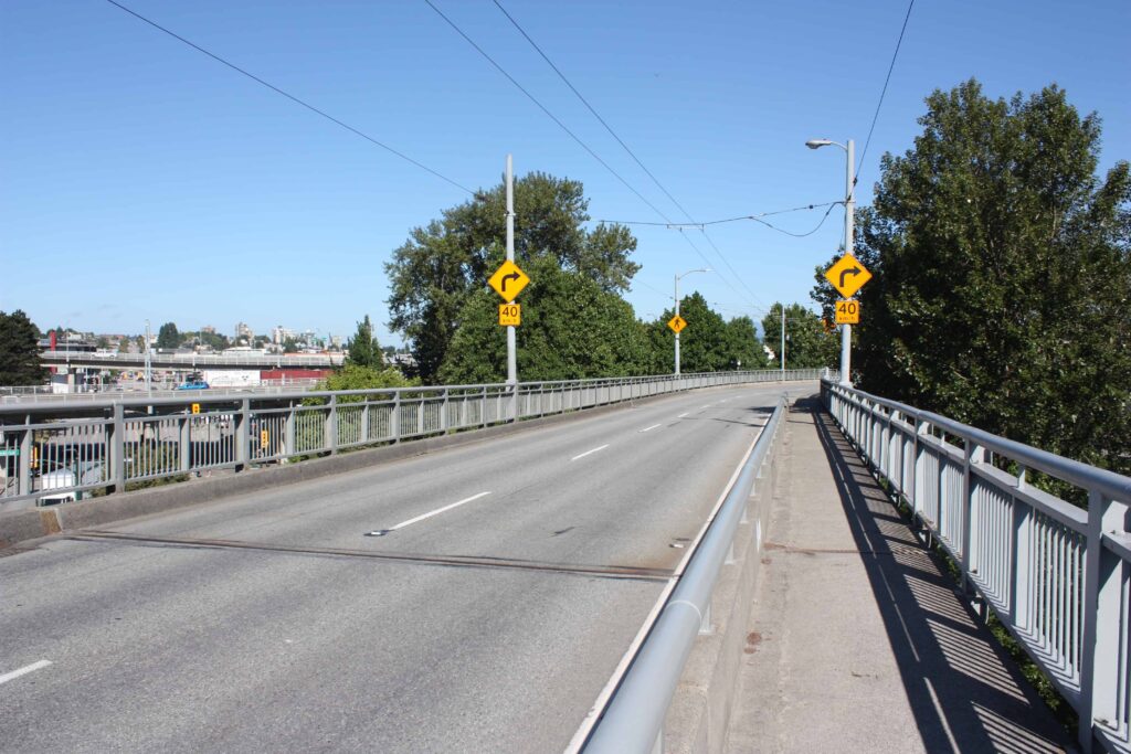
The current Granville Bridge opened in 1954 and was designed as if to fit into a future freeway scheme. It was a recommendation of the Town Planning Commission throughout the 1940s and was built high enough (274 metres), like the Burrard Bridge 20 years earlier, that its span did not have to be opened for marine traffic. The general contractors were Dawson Wade & Co in partnership with B.C. Bridge and Dredging Co. and the design was done by J. R. Grant with help from Pearson, Phillips and Barratt. It was built slightly west of the second Granville Bridge and more in line with the original bridge location of 1889. Its south-end ramps prompted the demolition of Athletic Park and the building of Capilano Stadium (now Nat Bailey Stadium), and the north-end ramps destroyed some housing in Yaletown.
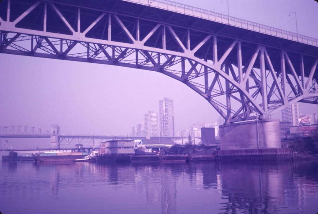
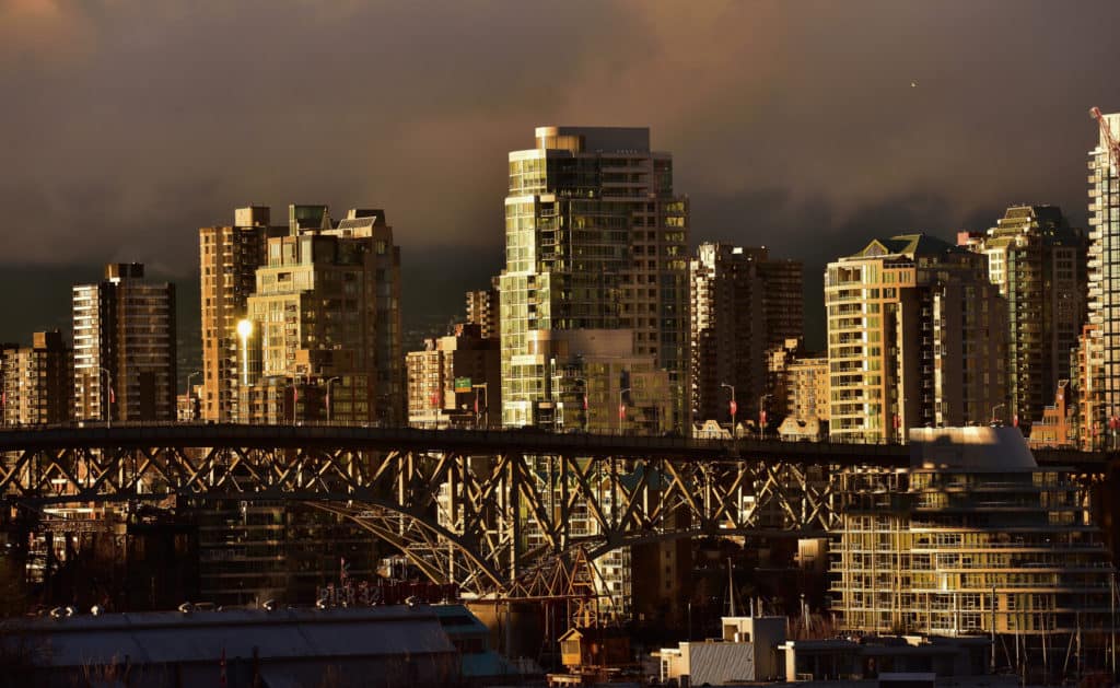
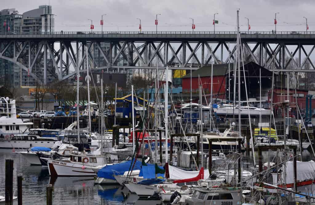
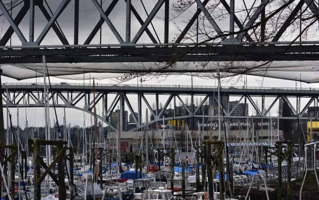
The Granville Bridge has remained largely unchanged since 1954, besides earthquake resistance improvements and higher curb barriers and medians, added in recent years. While the plaque on opening day read “Granville Bridge,” it has since become much more commonly known as the “Granville Street Bridge.” In 2018, Granville Island in partnership with Art Smash, commissioned nine new murals beneath the Granville Street Bridge, including pieces by Musqueam artist Debra Sparrow, which are painted on two pillars of the bridge.
The Future of the Granville Street Bridge
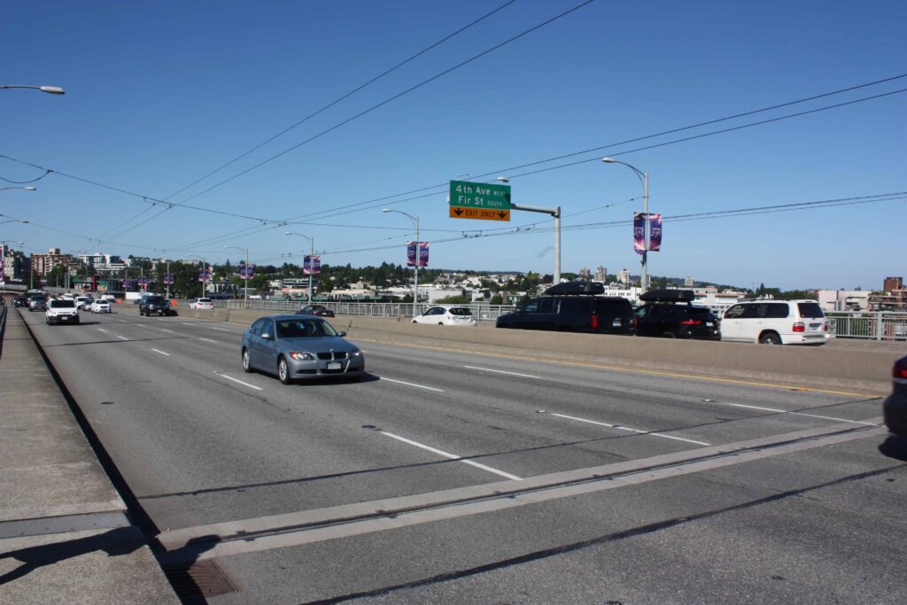
In 2017, the City of Vancouver approved a plan to demolish the exit ramp loops on the north end of the Granville Street Bridge, replacing them with a grid street system, and lots for development, and in July 2018, the City was accepting bids for long term lease and development of the land.
Also in 2017, the Canada Mortgage and Housing Corporation (CMHC), which operates Granville Island, presented Granville Island 2040, a revitalization plan which includes a proposed elevator and stairway connecting the middle of the Granville Street Bridge to Granville Island below. As part of the plan, the bridge would receive a significant makeover, with the two centre lanes becoming a greenway pedestrian and cycle path, with a bus stop midway. CMHC, in partnership with the municipal government, will be exploring the feasibility of this plan in the coming years.
Nearby Places That Matter
Sources
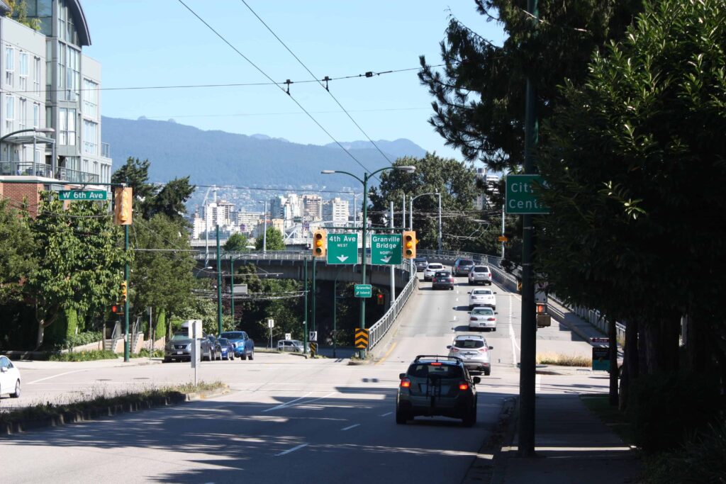
Granville Street Bridge
49.2697903, -123.1366029
Do you have a story to share? Do you have a site to nominate? Please fill out this form and we will get back to you.