Share a story! Nominate a site.
Do you have a story to share? Do you have a site to nominate? Please fill out this form and we will get back to you.
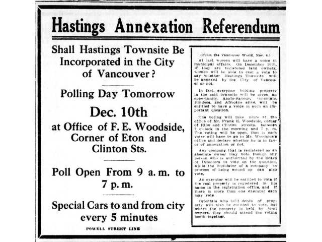
"On Dec. 10, 1910, property owners in Hastings Townsite voted to join the City of Vancouver. 'Only one man out of 1,200 voters declared against popular measure,' the Vancouver World reported. 'Adds 4,000 to the city population.'" - John Mackie, Vancouver Sun.
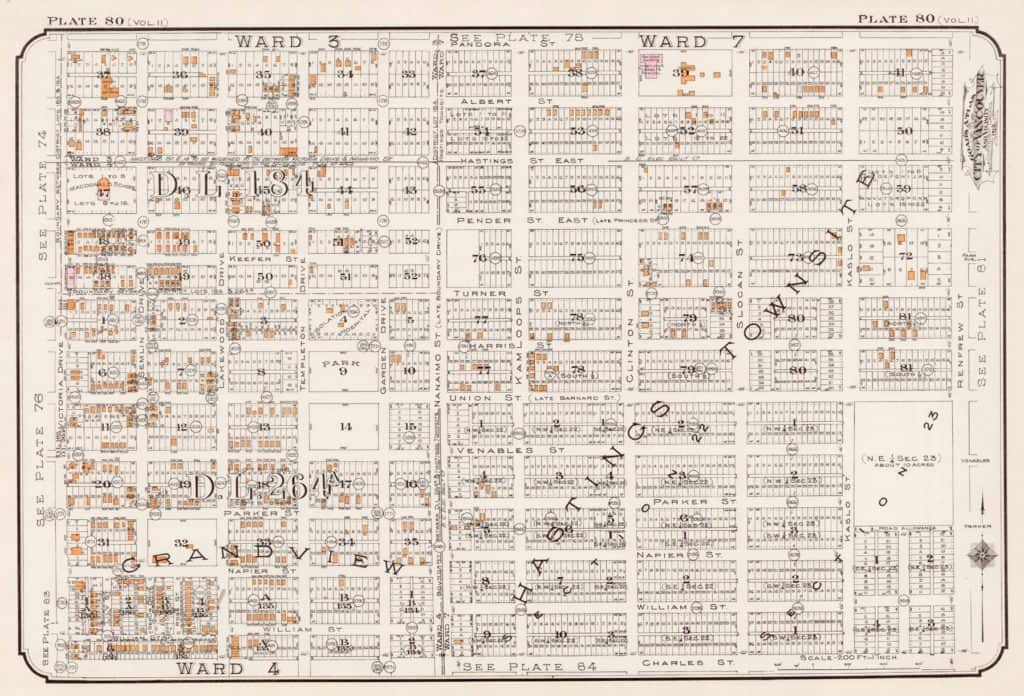
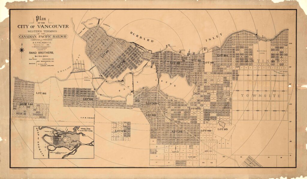
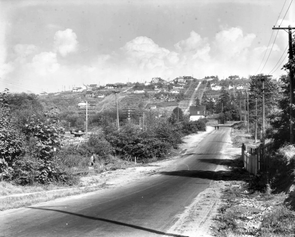
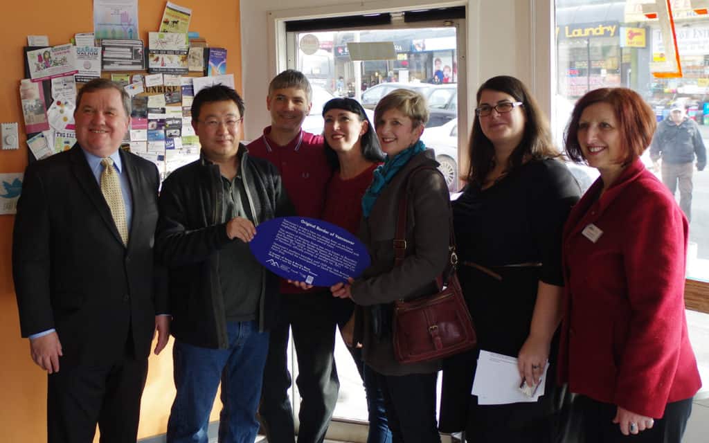
Vancouver’s borders have not always been as we know them today, as the city has expanded and consolidated with neighbouring municipalities several times. This section of Nanaimo Street was once known as Boundary Drive, when it was the eastern border of Vancouver. To the east was the Hastings Townsite, the government reserve which amalgamated with the City of Vancouver on December 21st, 1910. Vancouver’s southern boundary until 1929 was 16th Avenue, where it abutted the municipalities of South Vancouver and Point Grey.
In honour of Teresa and Martin Wong.
Help us find a cure for lupus and heart disease.
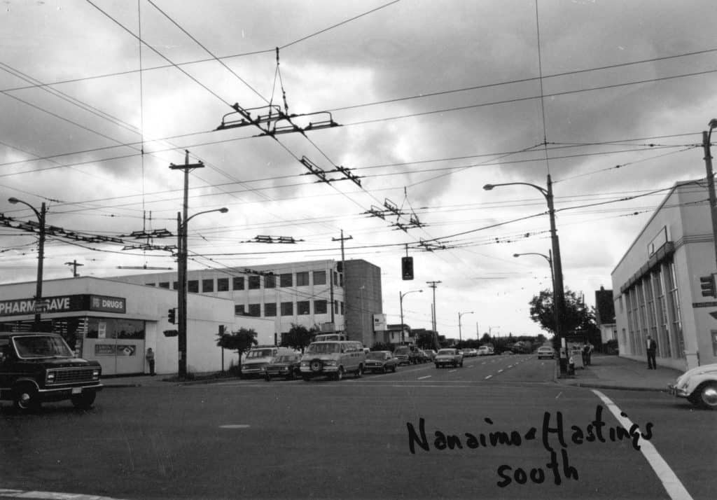
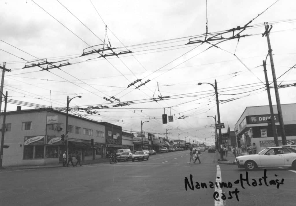
Nanaimo Street: Vancouver’s eastern border
Nanaimo Street was Vancouver’s eastern boundary from 1886 until 1910, when the sparsely settled Hastings Townsite to the east voted to amalgamate with it. The jogs in the east-west roads north of First Avenue (an area settled by the time of the amalgamation) reflect the different surveys on either side of the old boundary line. Vancouver’s southern boundary was at 16th Avenue until 1929, where it abutted the municipalities of South Vancouver and Point Grey.
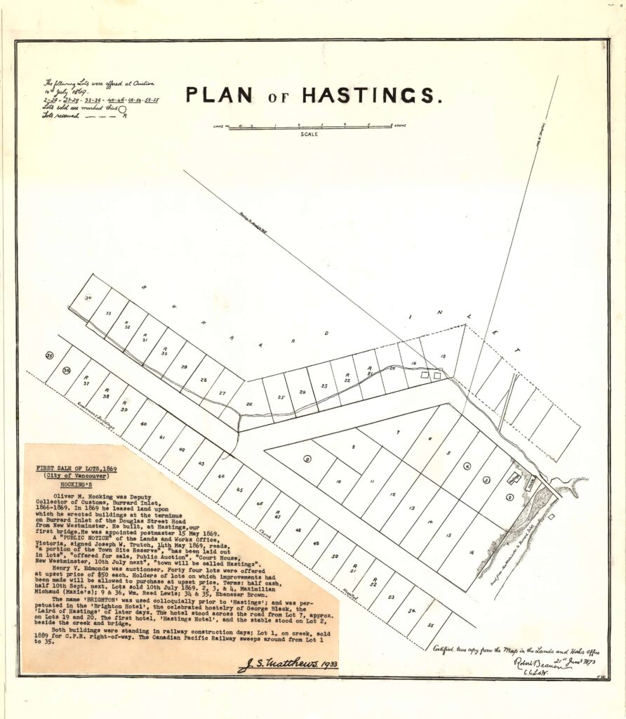
Hastings Townsite
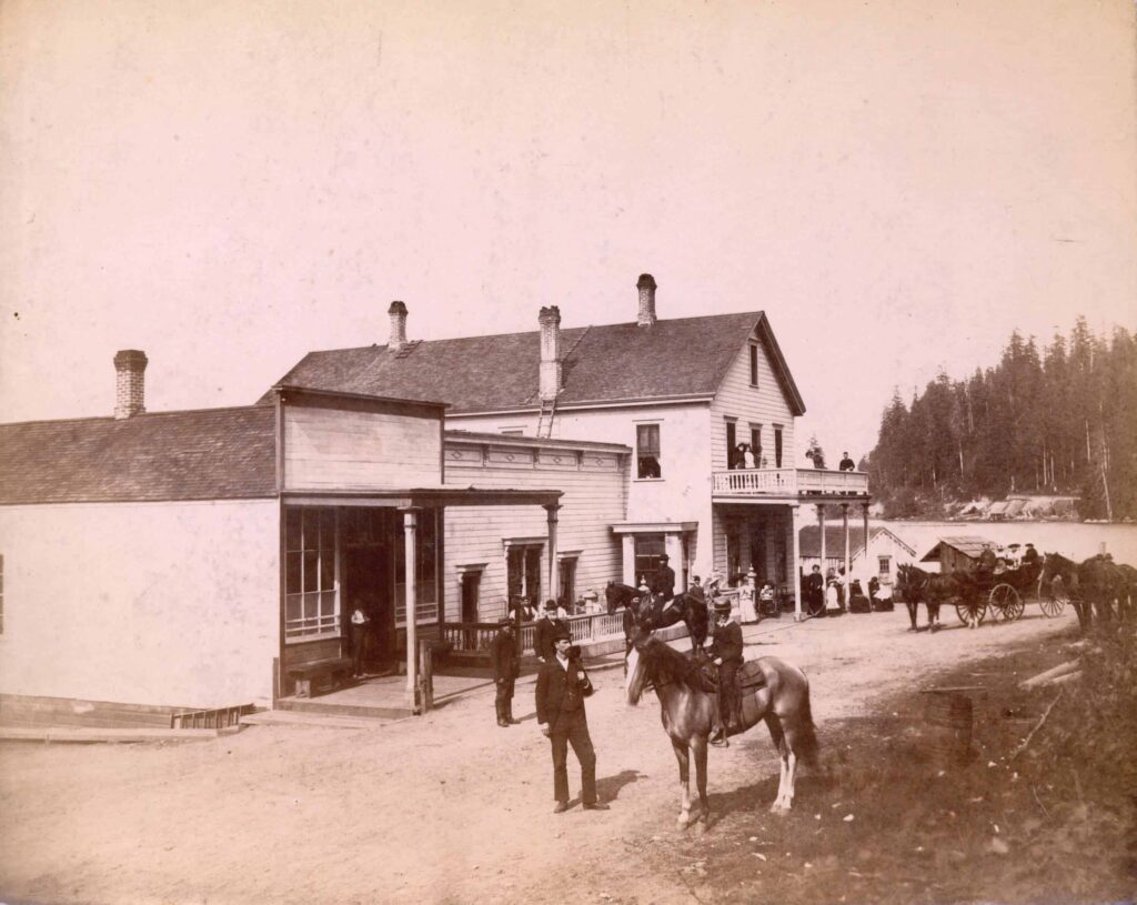
Hastings Townsite was a government reserve established in 1863; the only dot of settlement within it was the 1865 Brighton Hotel (at the site of New Brighton Park), linked to the outside world by a stagecoach, along Douglas Road to New Westminster, and a rowboat/ferry, to Moodyville sawmill in North Vancouver and Stamp’s Mill at Gastown. Its boundaries were Nanaimo Street, Boundary Road, Burrard Inlet and 29th Avenue. It grew rapidly with the arrival of streetcar service, to the Pacific National Exhibition, and the Burnaby Lake interurban line, which ran eastward along First Avenue from a station at 6th and Commercial Drive.
Changing street names
Until 1911, Nanaimo Street was known as Boundary Drive. Before that time, Nanaimo north of Ferndale Avenue was known as Graham Avenue, Ferndale and Graham being the southern and eastern boundaries of District Lot 184 (Graham Street was named for John Graham, who was in charge of the treasury department of the colony of British Columbia). A few other streets also changed their names, most notably Bismarck, which became Kitchener in 1915 during the patriotic fervour surrounding the First World War.
Adanac, the east-west bike route, is one of the few streets where there is no jog at Nanaimo. It was Union Street all the way from Main to Boundary Road, and beyond into Burnaby, until 1930, when a campaign succeeded in altering its name east of Vernon Drive to a backwards spelling of “Canada.” It is said that Union Street’s reputation as a red-light and bootlegging district prompted the change.
Sources / Read More
Nearby Places That Matter
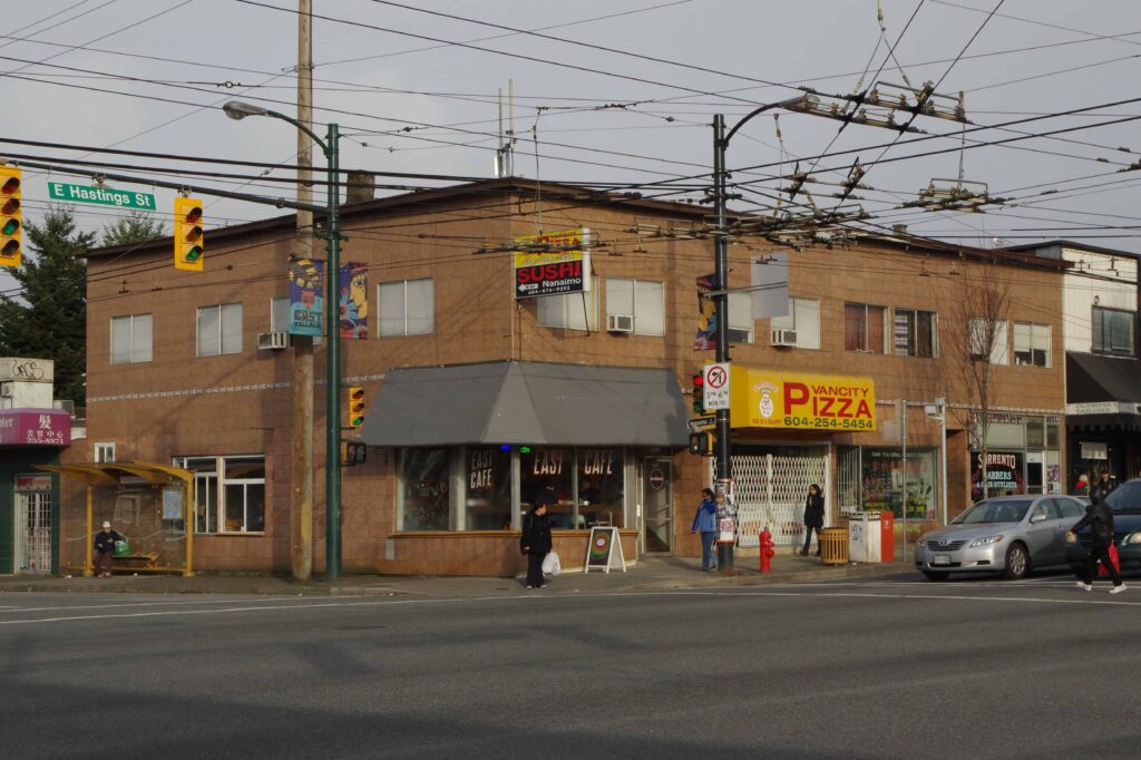
2401 E. Hastings (at Nanaimo)
Hastings-Sunrise
49.281346, -123.056267
Do you have a story to share? Do you have a site to nominate? Please fill out this form and we will get back to you.